
aerial view, Boston Marathon start, Hopkinton, MA (1994)
Boston marathon is today, with bad weather, so no flying. This image was made in 1994, flying in a R-22 with Anne Umphrey as pilot. Hopkinton, MA
aerial view, Boston Marathon start, Hopkinton, MA (1994)
Boston marathon is today, with bad weather, so no flying. This image was made in 1994, flying in a R-22 with Anne Umphrey as pilot. Hopkinton, MA
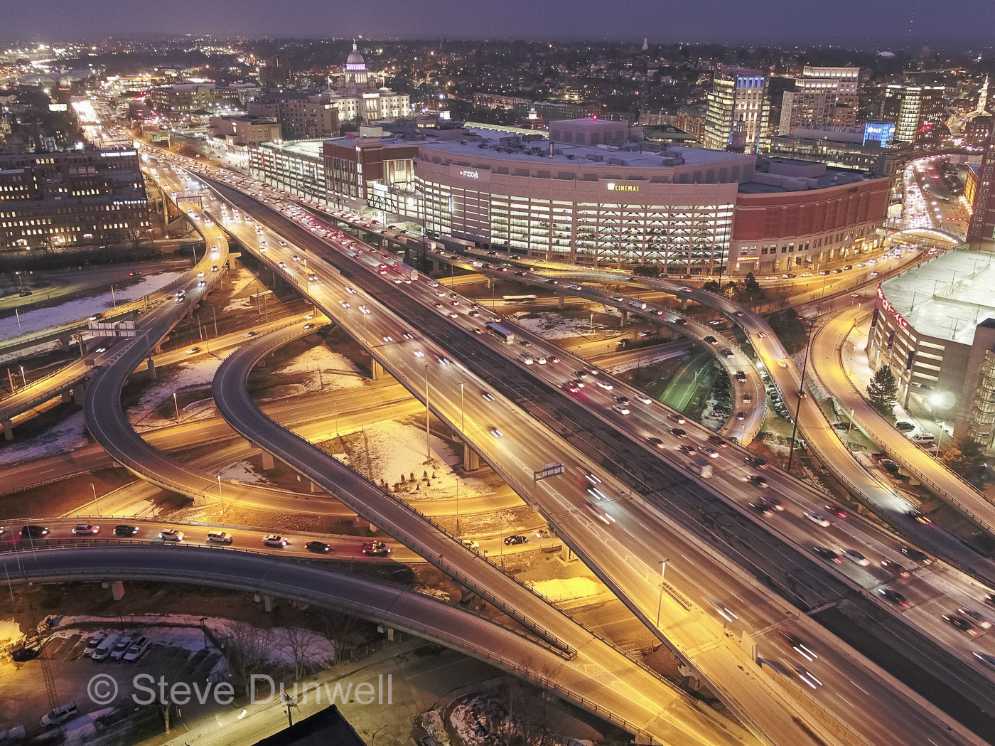
aerial view of Rt. 95 at Providence Place
Rush hour on Rt 95, as seen by the I2 drone flying over Federal Hill warehouses. This project was conceived for time-lapse, but some still frames are amazing on their own.
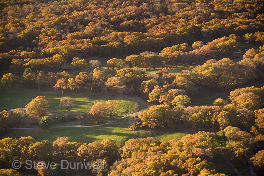
Aerial view, Franklin Park, Boston, MA
Franklin Park, designed by F. L. Olmsted, ca 1885. Oblique aerial showing the oak trees with autumn colors.
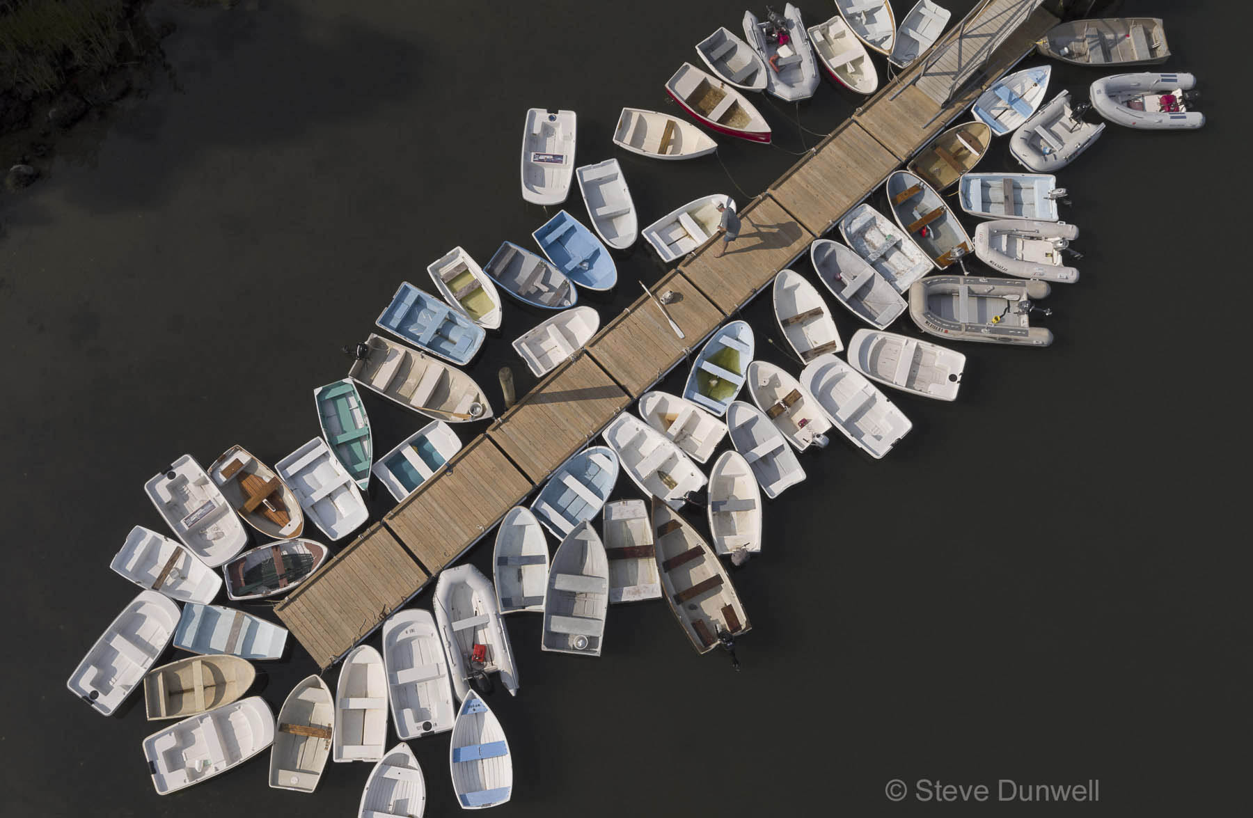 Dinghies on the floating dock, West Falmouth harbor. Drone UAV image, from about 50 ft up. Inspire 2 aircraft, with X5s camera.
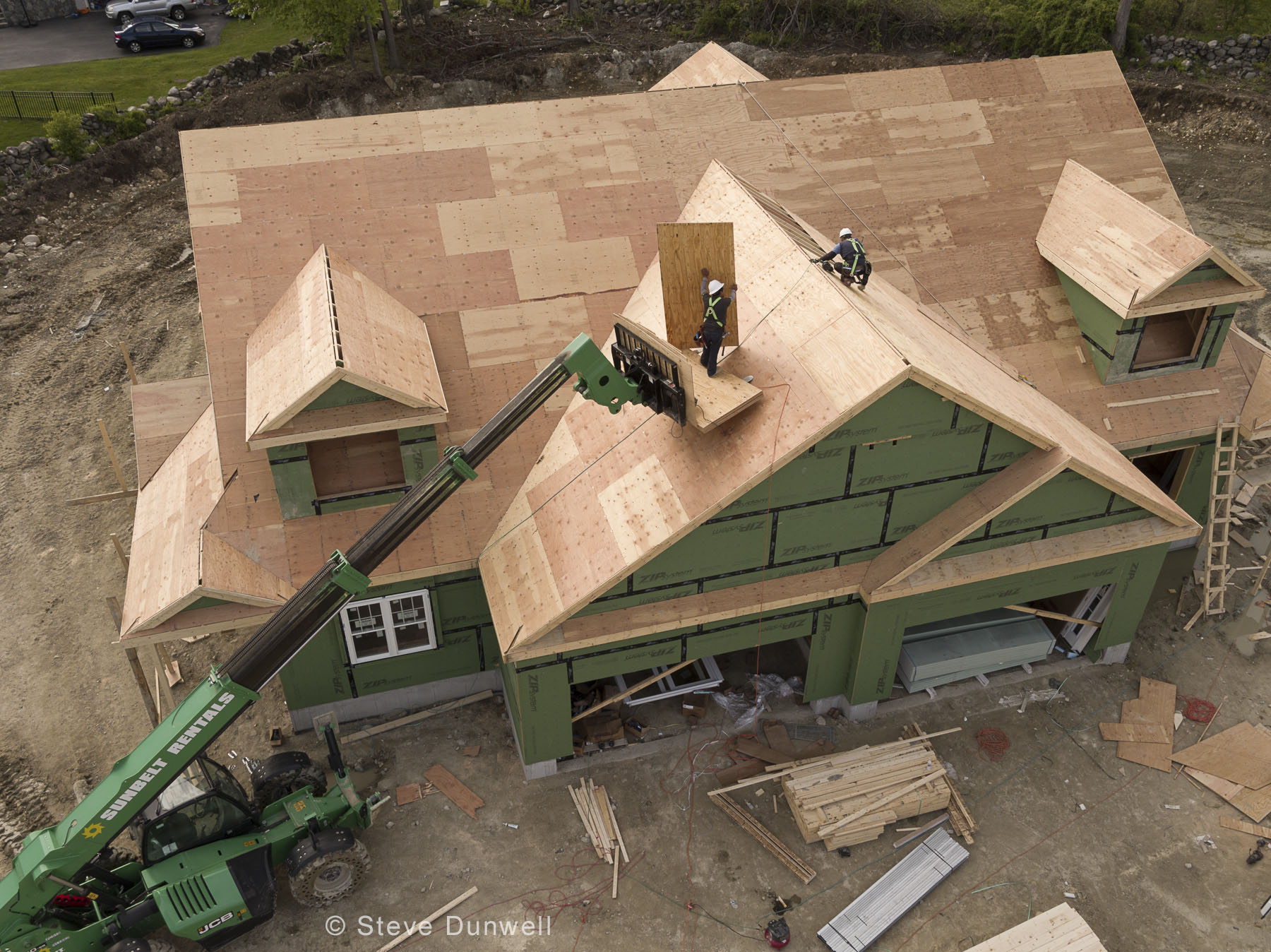 The UAV point of view allows low altitude work with surprising compositions. This construction site image was made from about 75 feet up.
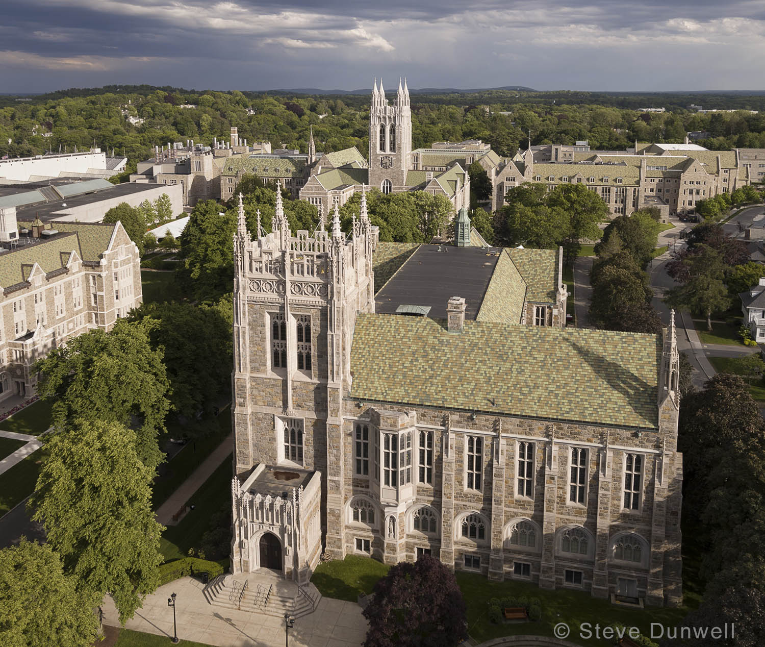 Boston College, Bapst Library. Photo drone UAV at about 200 ft elevation. Architect = Maginnis and Walsh, 1925
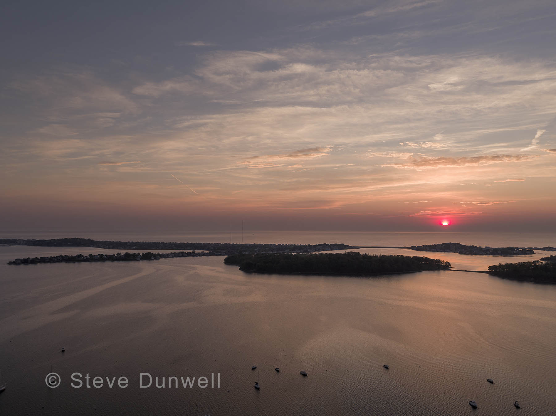 This aerial image was taken with the Inspire 2 drone UAV, at 400 ft, which is the legal limit. I am amazed at how well this machine flies. Best results when the wind is 10 kts or less.
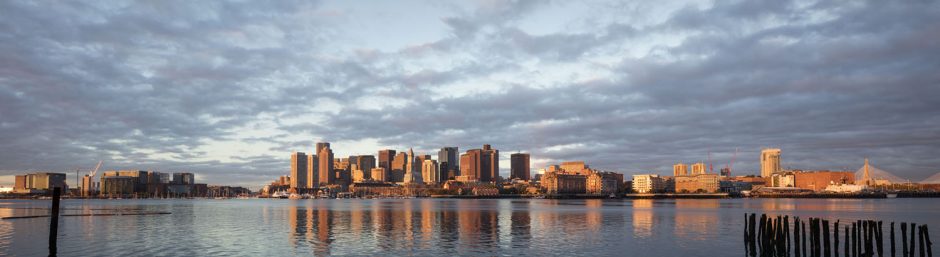
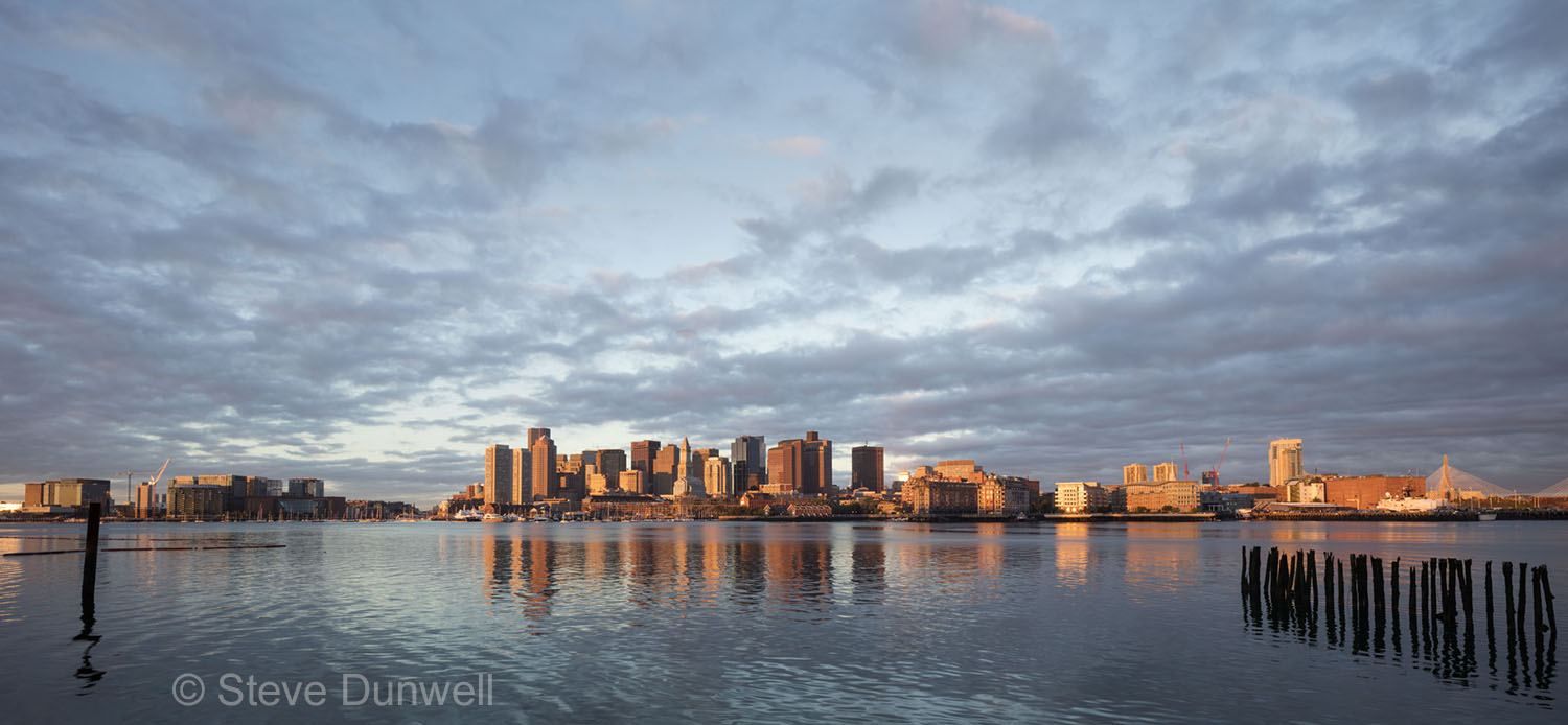 This image – “Sunrise skyline from East Boston” is the key photo in my exhibit “Above Boston” opening March 1 at Trinity Episcopal Church Parish Hall, 81 Elm St., Concord, MA. The show runs until May 1. Artist reception on Saturday, March 11, 3-5PM. This image was made with the Canon 17mm TS lens, 2 exposures R + L, stitched together for panoramic width.
 Back Bay, winter snow skyline evening view from the Arlington Street viaduct. Orange Line MBTA and Mass Turnpike.
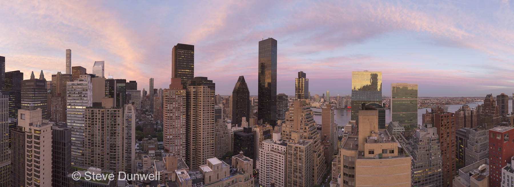 This 270 degree panorama taken from a terrace on East 44th St. Nodal point pano rig by Really Right Stuff. 8 verticals. Surprising clouds. UN on the right, looking East.